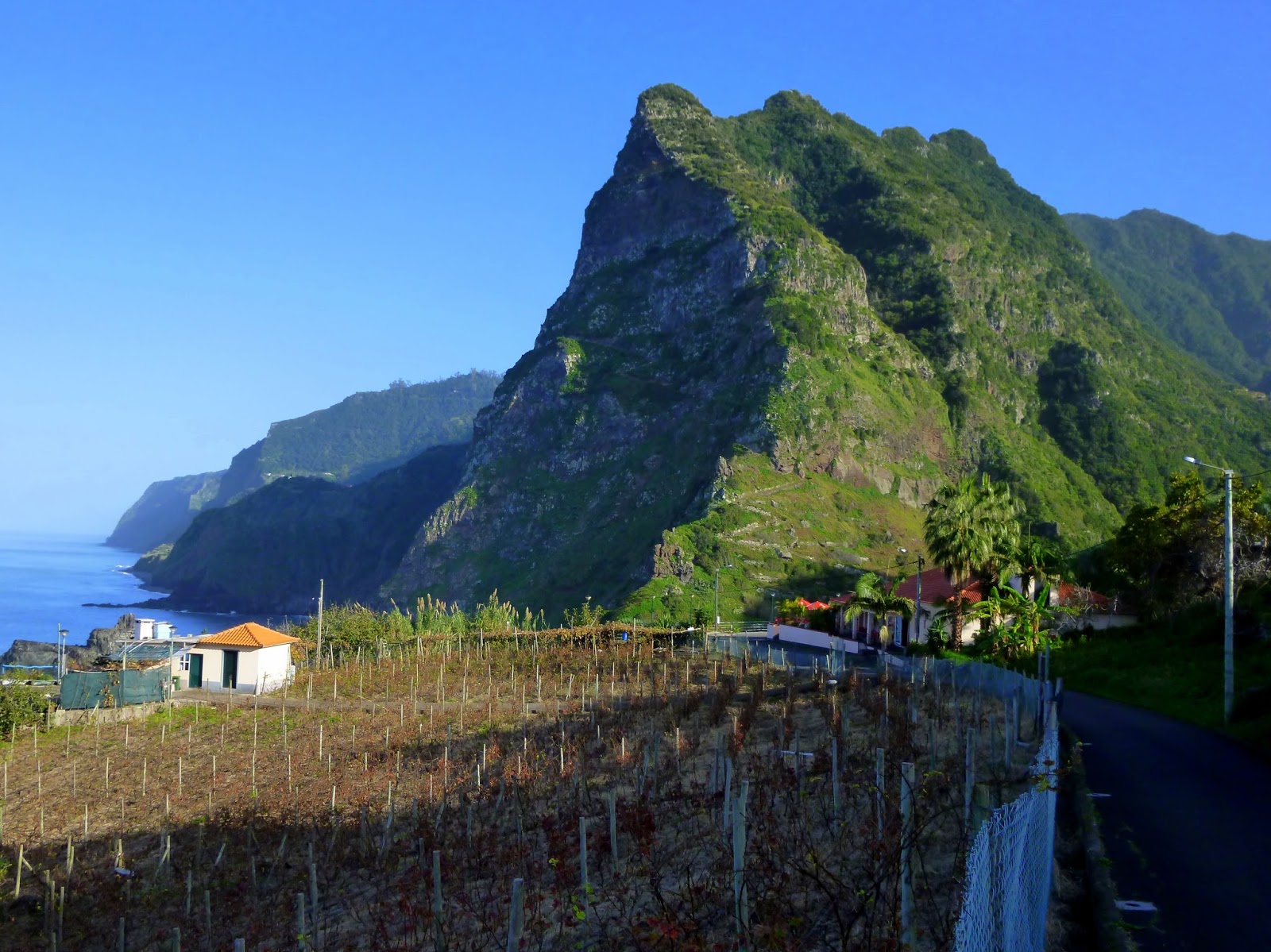
Another visit to one of my favourite islands ,arriving on 27th November and leaving on 7th December.Generally warm and sunny weather and I managed to do all the walks that I'd planned and more.
Link to photo album
here
An evening arrival at Funchal airport just in time for the bus to Funchal town.It was still warm enough to eat outside at a restaurant in the old town close by the Residencial Colombo where I was staying for the first four nights.
28th November
The bus to Santo da Serra wasn't until 10.30 so I was able to fit in a visit to the town market "Mercado dos Lavradores" beforehand.
I'd planned to buy some veg seed there but found some good value packets in a garden shop on the way.Mostly 0.85 cents each for a lot of seed per packet.Near the end of my stay I found a few more varieties in the supermarket at Machico and have now more or less completed my veg seed purchases ready for the 2016 season.
 |
| Bacalhau - salt cod |
 |
| Scabbard fish |
Today's walk was from Santo da Serra ,a small village which lies towards the eastern end of the island on about the 600 metre contour.In February 2010 I did a very wet walk from here west along the Levada do Tornos to Camacha so today I was going to take a look at the Levada Nova which runs to the south at a lower level.It's based on Walk 9 in Landscapes of Madeira (Sunflower Books) with the alternative finish back up to the village.
Mist and drizzle in Santo.Same as on my previous visits!Seems to be a wet spot.
I ignored the closed for walkers sign at the start of the channel near the Capela dos Cardais as I'd already seen from the geocaching site that the difficulties were few.It turned out to be just a few tree branches across the path and some care needed at a slight land slip near the next road crossing. The route was a bit "airy" in a few places before becoming less exposed in the ravine above Madre de Aqua.
 |
| Flight of steps down to the stream ,where you'd cross and go up the other side to get to the higher Lev do Tornos |
|
It took a bit of time to find the start of the way back up to Santo as the path was fairly overgrown after the summer but was a delightful route on the old camino. Pouring with rain nearing the end of the walk.
Time for a coffee and beer before catching the bus back to Funchal where it was warm and sunny and I had a walk along the sea front which has now been fully remodelled following the devastating floods in 2010.
 |
| Last year this area was still a waste ground behind hoardings |
Very pleased to see Funchal with it's new sea front which is so much nicer than before the floods.
29th November
Breakfast on the hotel 5th floor balcony with great views over Funchal and then a local bus up to Corujeira de Dentro at the top of the town west
of Monte and a walk along the old route of the Levada dos Tornos
into the deep ravine of the Ribeira Santa Lizia visiting a few geocaches
along the way.
 |
| Luxuriant vegetation at the top of the path where the waters of the old Tornos emerge from the mountain |
 |
| New flood defences post 2010 |
The return route took me steeply down to the valley floor to meet the new levada for the return to Corujeira de Dentro.After a beer in a bar that had the largest and highest definition tv that I've ever seen I carried on round to Monte before catching the bus back down into town.
30th November
Rodoeste 96 bus up to Corrida above Estreito de Camara de Lobos and Jardim da Serra.Unlike my previous walks up the cobbled road to the Boca da Corrida some kind Germans stopped to give me a lift on the very steep road. I then followed the main path to along Boca do Cerra before branching off on the Pico Grande route to reach the next col with Pico Cerco.Autumn colours very much in evidence.I'd been hoping to have a look further along the ridge towards Pico de Jorge but the mist came down and the hoped for cairns weren't very apparent.
Retraced my steps back through this lovely mountain landscape and got a lift back down to Estreito with some safari journey thrill seekers after a beer at the Marco bar.
 |
| New development at the Rotunda da Infante.Until recently this area was behind hoarding after devasting flood damage |
1st December
Caught the 81 bus to Faja dos Cardos at the head of the Nuns Valley to start my walk across the mountains to near Boa Ventura on the north coast ,where I was staying for the next three nights.I'd previously done the southern half up or down from Boca das Torrinhas at various times and also most of the northern half apart from the top section which had been very overgrown.Now was the time to complete the whole route given the path upgrades in the last few years.
The way up to the Boca is now much more straightforward than I remembered and the old track is in fine condition.The start of the path down on the north side is still fairly vegetated but this is probably due to the higher rainfall resulting in lush undergrowth.An amazing route that has been carved into the cliff face sidling round the mountain avoiding the frequent bluffs.
 |
| Falca villages above Boa Ventura |
A great walk.I'd fairly whizzed along in about 4 1/2 hours .A bit parched when I reached the bar at the main road junction and as I didn't feel the need to do the uphill road walk into the village I stopped for a couple of beers before catching the very handy 16.00 bus.
2nd December
Today's walk was put together from geocaching and Sunflower Books.I'd previosly done the middle part along the Levada de Cima before (Walk 27a) and also part of the Levada da Achada Grande not shown on walking maps but on Street/Cycle Map. Took the bus at around 9.00 up to Lombada above Ponta Delgada and started my walk with a look up the Ribeira da Camisa before returning through Lombada and up the road to the mast to get onto the Levada da Cima.
 |
| Holiday cottages Ribeira da Camisa |
 |
| Levada da Cima |
After arriving at it's source I used my local knowledge to locate the old path further up the Ganhalo valley which leads up to the higher levada and walked along this to the path junction and down to Boa Ventura.
As there was plenty of day left I continued down the lane to the Cristovao bar just above the coast and then returned back up to the village on the old cobbled path which meets the old road at the bend below the bar and chemist's.
 |
| Local knowledge helpful here |
 |
| Levada de Achada Grande |
 |
| Recent landslip cleared |
 |
| Start of the old path |
 |
| Near the top just below the village centre |
3rd December
A walk from the door back up the steps to Pastel and top levada to Achada Grande into the Urzal valley to explore the bottom of the ravine and Levada da Faias along to Lamaceiros and Faja do Penedo ,helped by the description on the geocaching site.
 |
| Above Pastel |
 |
| Short tunnel between the valleys |
 |
| The difficult bit |
The hamlets above Faja Penedo have the widest roads and the most zebra crossings that I've seen on Madeira.All they're waiting for now is traffic and people.
4th December
Moving base today from Boa Ventura to Porto da Cruz further east,so I caught the Rodoeste bus up to Arco de Sao Jorge and after a coffee and walk round took the next Horarios do Funchal bus via Santana and Cruzinhas to the road junction with Lombo Grande where the driver dropped me off for the start of my walk down the lane and onto the local levada to Sao Roque.This section was a repeat from a previous trip but today I was going to extend it through the lower ravine to Cancela. All of these local paths are now very well signposted and it's possible to do a circular walk to include the Levada Castelejo.
 |
| Bus interchange at Arco |
The steep path down to the ravine has some post and wire protection but is a bit overgrown near the bottom.It then hugs the base of the cliff, with a couple of exposes sections protected with "washing line".
Arriving at the road in Cancela I realised that there was a bus due which would take me to the Porto da Cruz "Tunel" stop on the motorway.It's then quite a long but pleasant walk down the winding old road into the town.
 |
| View from my hotel balcony |
5th December
Another walk from the door up to Lorano and round the cliff path to Boca do Risco then dropping down to Ribeira Seca and Machico. Mostly a repeat of a walk done on an early visit but this time I found some better ways through Lorano by following one of the local levadas.
 |
| Seems much nicer to follow this levada round to the next dip than use the tarmac road |
 |
| Steps up where the dirt track ends on cliff path begins |
 |
| Top of Ribeira Seca valley below Boca do Risco |
 |
| A well deserved beer |
Both of the late Saturday afternoon buses back to Porto go via Portela so it was safest to walk down to the Machico bus station to make sure that I was on the right bus route. Managed to find some more good value veg seeds at the Continente supermarket before the bus arrived.
6th December
My last full day on the island with a well timed Sunday morning (Sam) bus up to Portela to start my walk along the Levada Portela to Lamaceiros and then follow old paths up to Pico Suna and northwards along the ridge over Pedreiro and down to Batista da Cruz.After Pico Suna I did a diversion on part of the Levada Furado which had been closed on a previous trip.
 |
| Sea fed swimming pool at Porto da Cruz |
 |
| Chino and Pastel de nata |
 |
| Levada Portela |
 |
| Disused fire tower on Pico Suna (although there are still regular fires!) |
 |
| Levada Furada |
 |
| Bush ridge above Bastista |
 |
| You can follow the levada to it's source from here and then go up to Lombo Grande where I started my walk two days ago |
 |
| Penna de Aguia |
 |
| Finishing my walk in the fading daylight |